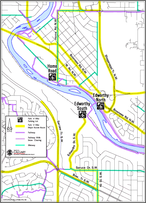
Calgary Park and Bike sites
Avoid downtown parking fees, exercise regularly, bypass traffic congestion, and discover Calgary's river pathways and bikeways. Seven Park and Bike sites are located five to eight kilometres from downtown Calgary. They feature direct access from major roads and great connections to river pathways.
Click on the locations below to see more information on accessing each Park and Bike site or view the full city map below.
Edworthy South
General Info: Parking lot is open but cyclists must cross the Edworthy pedestrian bridge and use the north Bow River pathway. The south pathway is closed due to flood damage.
Site offers easy access to the north and south sides of the Bow River pathway which both lead to downtown. The gate to the parking lot opens at 5 a.m. and closes at 11 p.m.
Site information:
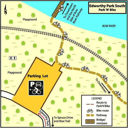
Route information:
Home Road
General Info: Access the site from highway 1 (16 Ave NW). Twinned pathways, cyclists must travel along Montgomery Ave to reach designated pathway.
Site information:
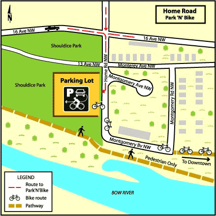
Route information:

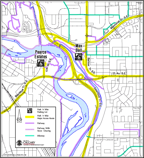
Max Bell Arena
General Info: The site can easily be accessed from Deerfoot Trail and Memorial Drive, westbound 17 Avenue S.E. and northbound Barlow Trail. The west side of the parking lot provides easy access to the pathway.
Site information:
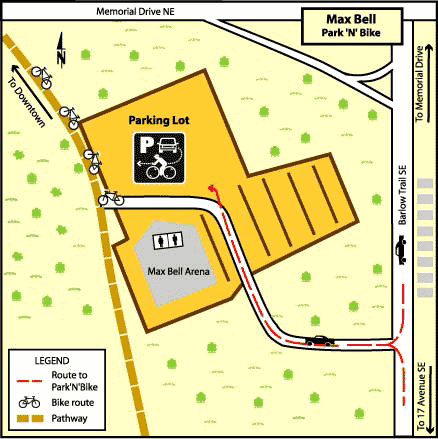
Route information:

Pearce Estates
General Info: The site can easily be accessed from Deerfoot Trail and Blackfoot Trail. The gate to the parking lot opens at 5 a.m. and closes at 11 p.m.
Site information:
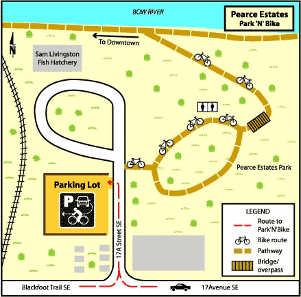
Route information:
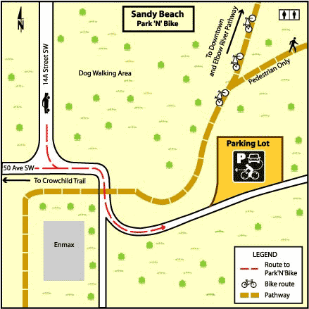
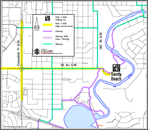
Sandy Beach
General Info: Access the site from 50 Ave S.W. by driving down the gravel road to the parking lot. From here, you can connect to the Elbow River pathway system.
Site information:
Route information:
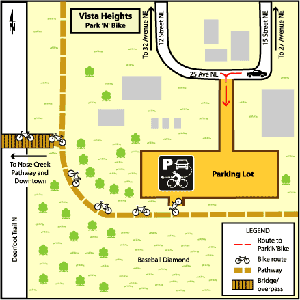
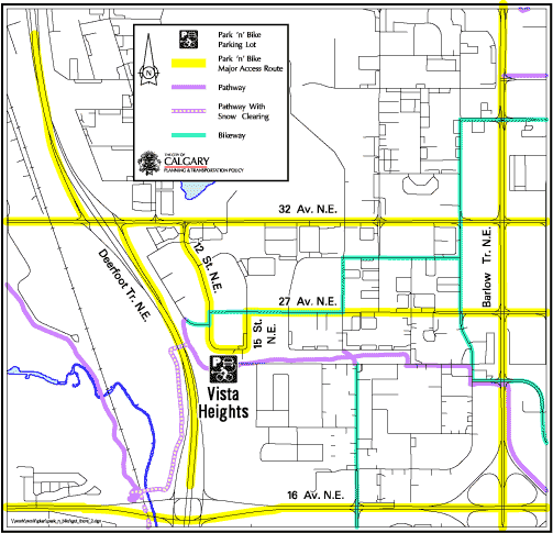
Vista Heights
General Info: Access the site from 32 Ave N.E. and park in the west-most corner of the lot for easy access to the Nose Creek pathway system.
Site information:
Route information:
Edworthy North
Closed | Upcoming Edworthy Park/Point McKay construction.
To support critical water infrastructure construction, park visitors to Edworthy Park and Point McKay can expect to see various construction activities and expect delays when accessing both the north and south parking lots throughout the year. Exact dates are not yet available, please visit Calgary.ca/BSFMproject regularly for updates as well as following any onsite signage.