Executive Summary
Executive Summary
Plan highlights
Current context
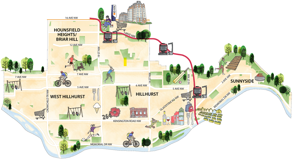
Destinations within the Plan Area such as the North Hill Mall and commercial corridors along 10 Street NW and Kensington Road NW attract and employ people from across Calgary and beyond. The Southern Alberta Jubilee Auditorium, Southern Alberta Institute of Technology and Alberta University of Arts campuses are also located just outside the Plan Area boundary west of 14 Street NW. Various parks and green spaces, such as Riley Park and Poppy Plaza, further support with drawing activity into and throughout the Riley Communities.
Within the Plan Area includes two Red Line LRT Stations: Lions Park and Sunnyside, along with a MAX Orange stop along 16 Avenue NW. Primary Transit Networks run north- and southbound along Crowchild Trail NW, 14 Street NW and 10 Street NW and west- and eastbound along 16 Avenue NW, Parkdale Boulevard NW and Kensington Road NW.
Hillhurst
Prior to residential or commercial development in the community, Hillhurst was the site of industry, utilities and services activities. In 1904, Ezra Riley registered Plan 5609J and named it Hillhurst. Additional residential subdivisions would follow and with the construction of the Louise Bridge in 1906 and the introduction of a complete streetcar loop in the 1910s, mixed-use areas emerged along 10 Street NW and Kensington Road NW. Hillhurst continues to evolve and consists largely of residential uses, with mixed-use corridors spanning along Kensington Road NW, 14 Street NW and 10 Street NW. Other major destinations include Riley Park, Hillhurst Sunnyside Park, Hillhurst Community School, Queen Elizabeth High School and the former Grace Hospital site.
Hounsfield Heights / Briar Hill
The lands where Hounsfield Heights / Briar Hill locate were first used as part of a cattle range by two cousins. The Alexander cousins would sell their land to the Riley family and following annexation in 1910, the lands of Hounsfield Heights were subdivided into a largely residential neighbourhood. Only eleven houses were built in Hounsfield Heights prior to the First World War and development would not begin again until after the Great Depression and World War Two. Briar Hill, started to develop into a residential area in the early 1950s and the city’s first purpose-built indoor shopping mall, Calgary Centre (later renamed North Hill Shopping Centre) was completed in 1958 alongside other commercial uses along 16 Avenue NW. The introduction of the Red Line LRT in the 1980s would further shape the community and lead to the twin-tower Renaissance project, the community’s first transit-station area development. Today, Hounsfield Heights / Briar Hill continues to evolve and experience residential infill development as a well-connected residential area anchored by the North Hill Shopping Centre and Lions Park Transit Station, along with commercial strip malls near the intersection of 16 Avenue NW and 19 Street NW. In addition to the Briar Hill School site, there are several public park spaces throughout the community which include the Louise Riley Park and Library and Hounsfield Heights Park. Additional institutional and alternative residential uses are located along 8 Avenue NW.
Sunnyside
Sunnyside expanded residential development east along the Bow River when it was first subdivided in 1907. Prior to subdivision, it was home to several Indigenous encampments along the Bow River up until 1880. Homesteaders later located in the area and the completion of the Louise Bridge in 1906 and the streetcar network extension into Sunnyside in 1912 greatly impacted this community as it provided the context for the community to be a working-class district in the years leading to the First World War. This enabled further residential infill development in the 1920s despite its location in the Bow River floodplain and several historical floods that caused extensive damage. In recent years, Sunnyside has continued to experience residential infill development alongside new flood protection investments. A significant concentration of buildings and sites on the City’s Inventory of Evaluated Historic Resources remain in the community and illustrate the community’s rich history. Major destinations that define the community include the Calgary Curling Club, the Field of Crosses and the 10 Street NW Main Street - one of the Plan area’s more prominent Main Streets.
West Hillhurst
Agricultural settlement in present-day West Hillhurst began in the 1880s with several homesteads. Most of present-day West Hillhurst was initially granted by the Crown to the Canadian Pacific Railway (CPR) as an incentive to construct a transcontinental railway. Subdivision development began in 1906, creating many of the smaller communities that were eventually amalgamated in to the West Hillhurst community area of today, namely Upper Hillhurst, Grand Trunk, Westmont, Happy Land and a portion of Parkdale. Extension of the streetcar network into the area in the early 1900s helped to create the connected community we know of today. West Hillhurst continues to transform into a well-connected residential community supported by a variety of commercial and institutional uses situated along Kensington Road NW, 19 Street NW and Crowchild Trail NW. Like Hillhurst and Sunnyside, West Hillhurst has excellent access to the park network along the Bow River, as well as several parks throughout the community, which includes West Hillhurst Park and Helicopter Park.
Future evolution
The Riley Communities Local Area Plan was developed to guide where and how this area can continue to evolve over time. An overview of some of the future community improvements that are envisioned for the area, as well as key locations where different types of new development are envisioned are summarized below.
Key moves
The Plan’s key moves are aligned with the core values, found in Chapter 1.
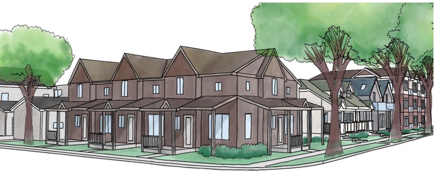
Supporting diverse housing options to meet the evolving needs of existing and future residents
- Improving access to a range of housing choices
- Building sense of place through heritage initiatives
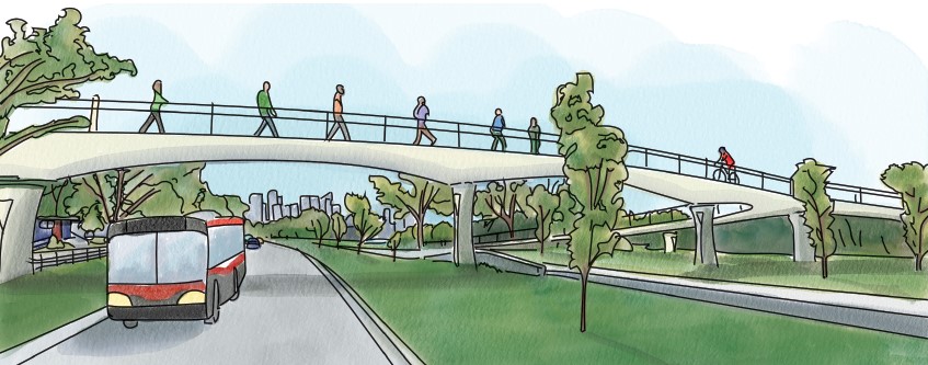
Improving connectivity for all mobility options between destinations within and beyond the Plan Area
- Connecting Riley Communities through multi-modal mobility improvements
- Connecting people and places through improvements along neighbourhood main streets
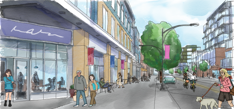
- Enhancing Kensington Road NW as a connected and safe multi-modal main street
- Strengthening pedestrian connections across and along a vibrant 14 Street NW
- Enhancing 10 street NW as a well-connected regional destination for all calgarians
- Implementing Crowchild Trail improvements and providing better grade separated east-west connectivity over Crowchild Trail
- Realizing a multi-modal bridge across the Bow River
- Moving beyond a parkway and improving Memorial Drive NW for all modes
- Enabling 14 Avenue NW to better connect all modes across the northern edge of the Plan area
- Investing in place and safety for all modes along 19 street NW
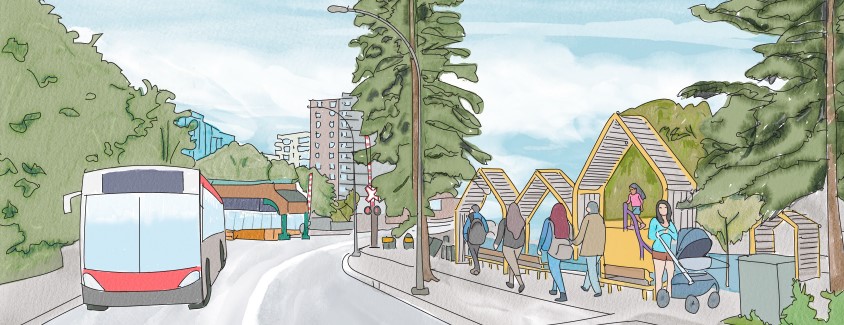
- Improving transit service through a new west bow BRT line
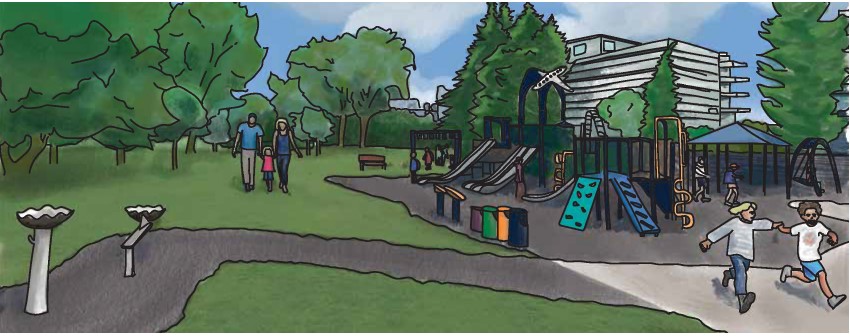
Enhancing and conserving existing parks, open spaces and natural areas
- Improving quality and function of parks and public spaces
- Establishing a new green corridor in West Hillhurst
- Reimagining the Louise Riley Library site

Strengthening climate resilient infrastructure and design measures through new developments
- Greening the Riley Communities
- Enabling more energy efficient communities
- Adapting to a changing climate and communities through prioritizing stormwater retention and mitigation
- Enhancing flood resilience in the Riley Communities
Ensuring the community is safe and accessible for all age groups and demographics
- Ensuring vibrant and safe transit station areas that better connect the Riley Communities to the rest of the city
Focus areas for new development
Key locations for commercial development
Neighbourhood commercial
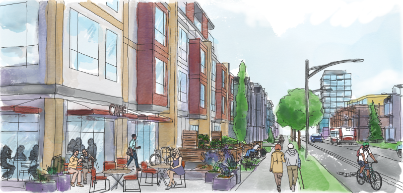
Opportunities for both new and expanding commercial amenities are envisioned at key nodes along 19 Street NW (at 16 Avenue NW and Kensington Road NW), further west along Kensington Road NW and Kensington Close NW between 14 Street NW and 10 Street NW, continuing north along 10 Street NW until 4 Avenue NW. Active Frontages are envisioned along the aforementioned Kensington Road NW and 10 Street NW stretches.
Key locations for mixed-use development
Neighbourhood flex
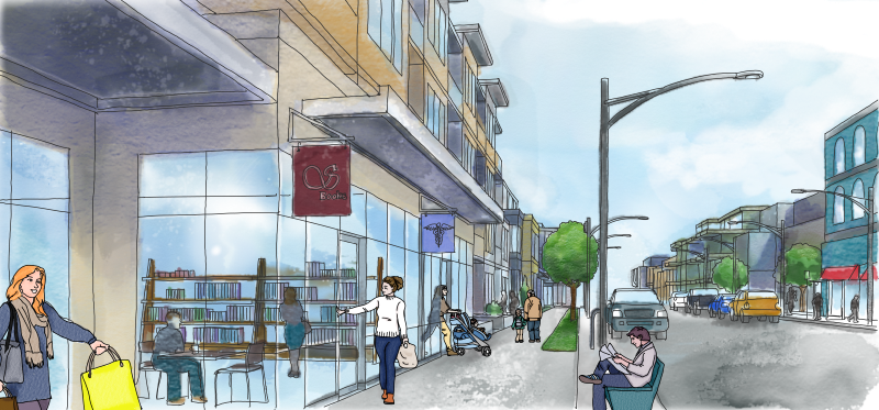
Opportunities for new mixed-use development (either fully residential, fully commercial or a combination of both) are envisioned at key nodes near Crowchild Trail NW and 5 Avenue NW, 20 Street NW and 12 Avenue NW, along 8 Avenue NW between 18A and 17 Street NW and the old Grace Hospital site. Further opportunities have been identified along Parkdale Boulevard NW, Kensington Road NW, 19 Street NW, 14 Street NW, 10 Street NW and 2 Avenue NW.
Key locations for residential with local shops
Neighbourhood connector
Opportunities for a range of different housing types allowing for limited smaller-scale commercial are envisioned throughout the Plan Area, located predominantly around Transit Station Areas, Collector roads and other more active corridors that connect to non-residential uses.
Key locations for residential development
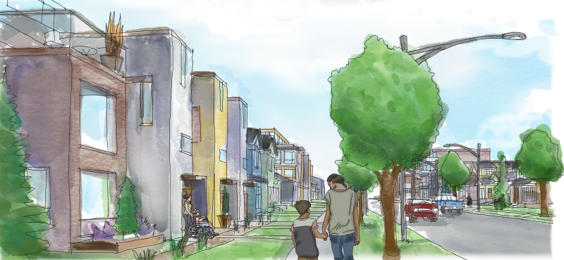
Neighbourhood local
Opportunities for residential homes or home-based businesses continue to be predominant throughout the Plan Area.